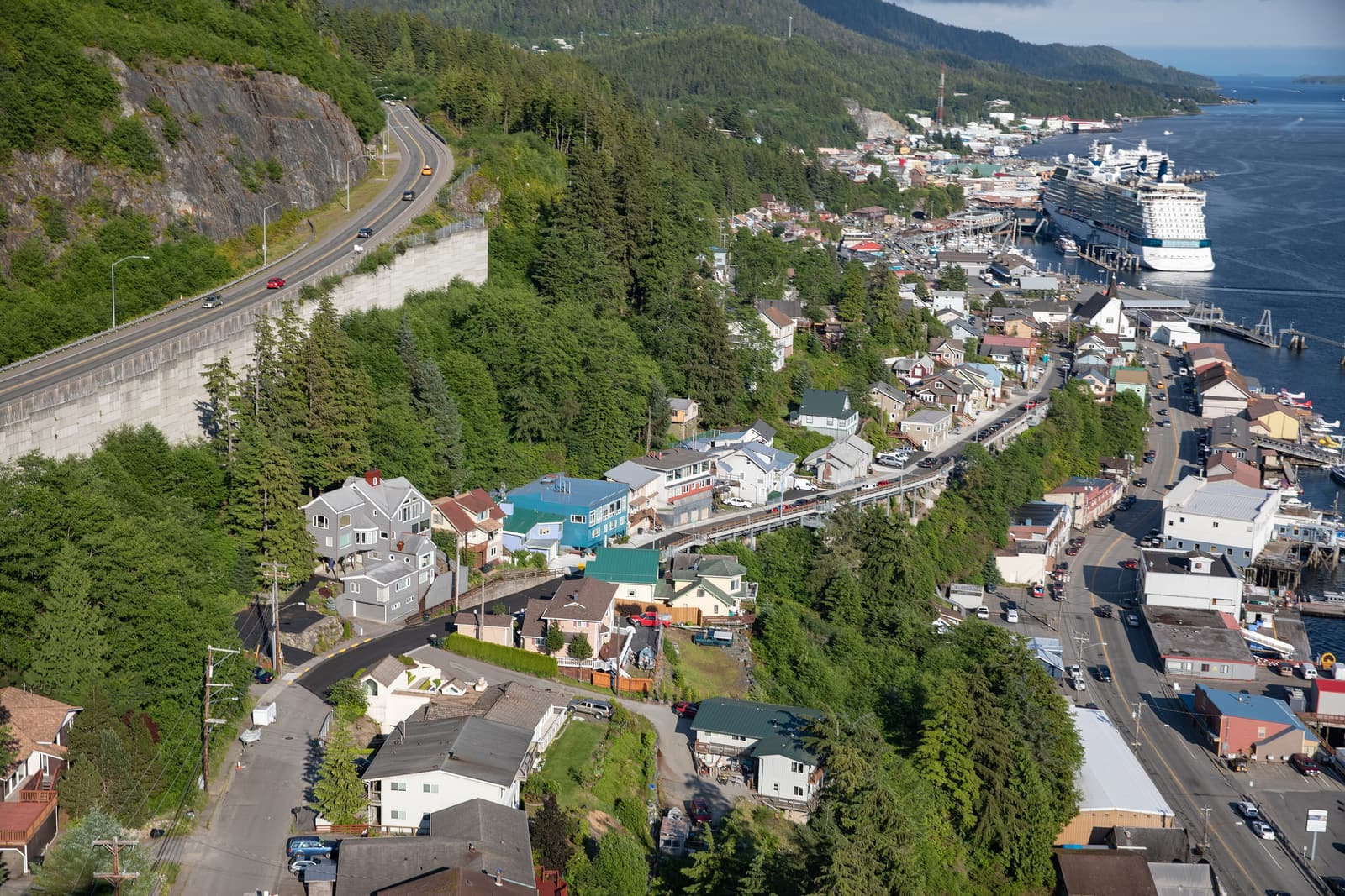
Ketchikan sits on Revillagigedo Island in the far south of the Alaska Panhandle, about 680 miles (1,100 km) north of Seattle and 235 miles (380 km) south of Juneau. There is no road or bridge to the mainland road system. Most visitors step off a cruise ship; the rest fly into an airport on the neighbouring island or arrive on the state ferry.
The options, compared
| How | From | Time | Good to know |
|---|---|---|---|
| Cruise ship (downtown) | Inside Passage itineraries | Typical call 6–10 h | Berths 1–4 line the downtown waterfront |
| Cruise ship (Ward Cove) | Mainly Norwegian Cruise Line group ships | Shuttle about 20 min | About 7 miles north of downtown |
| Flight | Seattle | About 2 h nonstop | Airport is on Gravina Island — short ferry to town |
| Flight | Juneau, Sitka, Wrangell, Petersburg | About 1 h or less | “Milk run” hops along the Panhandle |
| Alaska Marine Highway | Bellingham, Washington | About 36–40 h | Cabins and car space sell out for summer |
| Inter-Island Ferry | Hollis, Prince of Wales Island | About 3 h | Usually one round trip a day |
Arriving by cruise ship
The downtown berths
Ketchikan has four cruise berths in a row along the downtown waterfront, numbered 1 to 4 from south to north. Berths 1 and 2 are right in the centre: you walk off the ship onto Front Street, with the visitor information centre on the dock, the lumberjack show a few minutes away and Creek Street 5–10 minutes on foot. Berth 3 is a little further north, by the tunnel. Berth 4 is the furthest, roughly 15–20 minutes’ walk along the waterfront promenade to Creek Street.
| Walk from Berths 1–2 to… | Distance | Time |
|---|---|---|
| Visitor centre / tour kiosks | on the dock | 1–2 min |
| Great Alaskan Lumberjack Show | about 0.2 mi (300 m) | about 5 min |
| Southeast Alaska Discovery Center | about 0.2 mi (300 m) | about 5 min |
| Creek Street | about 0.3 mi (500 m) | 5–10 min |
| Salmon ladder | about 0.5 mi (800 m) | 10–15 min |
| Totem Heritage Center | about 0.9 mi (1.4 km) | 20–25 min |
Distances are approximate; add 10 minutes from Berth 4. In summer a free downtown shuttle bus has usually looped between the berths, Creek Street and the Totem Heritage Center — look for the stop signs on the dock and check the current timetable.
Ward Cove
Since 2021 some ships — mainly those of Norwegian Cruise Line and its sister brands — have docked at The Mill at Ward Cove, a converted pulp-mill site about 7 miles (11 km) north of downtown. You cannot sensibly walk into town from here. Complimentary shuttle buses run to and from downtown throughout the port call; the ride takes around 20 minutes, but queues build up just after arrival and before all-aboard. Allow at least 45 minutes door to door in each direction, and check whether your tour picks up at Ward Cove or downtown. On the plus side, Ward Cove is close to Ward Lake and Totem Bight.
By air: Ketchikan International Airport (KTN)
The airport is on Gravina Island, across the Tongass Narrows from town — the site of the famous, never-built “Bridge to Nowhere”. Alaska Airlines flies here year-round from Seattle (about two hours) and links Ketchikan with Juneau, Sitka, Wrangell, Petersburg and Anchorage; another carrier has operated summer flights from Seattle in recent years. Check current schedules.
- The airport ferry: a small vehicle and passenger ferry crosses the Narrows in about five to seven minutes, typically every 30 minutes and more often at peak summer times. Foot passengers pay a modest fare (a few dollars, covering the return). The ferry ramp is a short walk downhill from the terminal.
- From the ferry landing to downtown: the town-side landing is about 2.5 miles (4 km) north of the centre. Taxis wait there, borough buses pass on Tongass Avenue, and several hotels run courtesy shuttles — ask when you book.
- Allow time: when leaving, be on a ferry at least 60–90 minutes before your flight.
By ferry: the Alaska Marine Highway
The state ferry system links Ketchikan with Bellingham, Washington (roughly a day and a half at sea through the Inside Passage) and northwards with Wrangell, Petersburg, Juneau, Haines and Skagway. Sailings are infrequent — often about once a week on the long routes — and schedules change by season, so plan around the ferry, not the other way round. Service to Prince Rupert in British Columbia has been suspended or irregular in recent years; check before counting on it. The terminal is about 2.5 miles north of downtown, close to the airport ferry.
The separate Inter-Island Ferry Authority sails between Ketchikan and Hollis on Prince of Wales Island in about three hours, and a small state ferry serves the Tsimshian community of Metlakatla on Annette Island.
Getting around Ketchikan
- On foot: downtown, Creek Street, the museums and the salmon ladder are all walkable. Expect some stairs — parts of Ketchikan are built on wooden staircases instead of streets.
- The Bus: the borough’s public buses run along the highway roughly hourly, north as far as Totem Bight and south through Saxman. Fares are low (a couple of dollars; carry small bills). Check the timetable against your ship’s departure.
- Taxis and rideshare: taxis meet ships and ferries and some offer hourly sightseeing rates. App-based rides exist but are limited.
- Car rental: available at the airport and in town; worthwhile for independent travellers. The road network is small — about 18 miles north to Settlers Cove and 13 miles south past Herring Cove.
- Tours: for a short port call, an excursion with transport is usually the most efficient choice. Compare them on our tours page.